
If we know the height of the world’s forests, then we can estimate how much carbon they store. That will improve our understanding of how forests interact with the atmosphere and their role in mitigating climate change. To make those measurements, a collaboration including Brown University ecologist Jim Kellner is putting a sophisticated laser scanner on the International Space Station in 2019.
NASA recently announced that the International Space Station will host two new environmental measurement instruments. Jim Kellner, assistant professor of ecology and evolutionary biology who is also affiliated with Brown’s Institute for the Study of Environment and Society, is a collaborator on one of those: the Global Ecosystem Dynamics Investigation (GEDI). Beginning in 2019, a sophisticated laser scanner will measure forest heights around the world over its nominal one year mission length, which will help scientists infer how much carbon is stored in forests and how it is changing over time, a key piece of information for understanding climate change.
Kellner talked with David Orenstein about the importance of the project, how the instrument and data analysis works, and his specific role in the collaboration, which in addition to Brown includes NASA, the University of Maryland, Woods Hole Research Center, and the U.S. Forest Service.
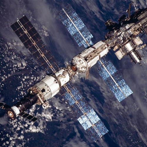
Measuring with the speed of light. Beginning in 2019, the International Space Station will carry LiDAR (Light Detection And Ranging)), a sensor that uses lasers to measure the height of Earth’s forest canopies. It’s a way to calculate how much carbon forests store. Image credit: NASA
What is the GEDI Project?
The objective is to put a sensor on the International Space Station called LiDAR, which stands for light detection and ranging. What LiDAR allows you to do is to obtain measurements of forest height and vertical structure. The project is aiming to collect measurements of forest height within essentially all temperate and tropical forests worldwide.
Why is this the project important?
It’s important in the context of the global carbon cycle and the role of forests in mitigating climate change. Globally, forests store a large amount of carbon in wood and other plant tissues. Trees grow by removing CO2 from the atmosphere by way of photosynthesis. At the same time, forests respire and trees die, causing CO2 to flow back to the atmosphere. The balance between these inputs and outputs determines whether a forest takes up more CO2 than it emits and is a net sink, or emits more than it takes up and is a net source.
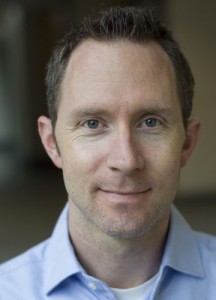
Jim Kellner. “Another important contribution of the project will be helping to identify the location of significant carbon sinks in the world’s forests.” Photo credit: Mike Cohea/Brown University
Temperate forests are a consistent carbon sink, which means that temperate forests are increasing in mass and slowing the rate of increase in atmospheric CO2. Tropical forests are less certain, and measurements from different sources point toward different conclusions about their source or sink status.
Studies of the atmosphere in South America suggest that source-sink status of forests in the Amazon Basin changes through time and depends on fluctuations in climate. Hotter and dryer years are associated with net fluxes to the atmosphere, and cooler, wetter years are associated with net carbon uptake. However, measurements of trees within plots show increases in carbon storage in South American and African tropical forests. Whether measurements from plots produce unbiased estimates of source-sink status is unclear, because forested landscapes that are recovering from previous episodes of disturbance, such as pest outbreaks, pre-Columbian agriculture or hurricane damage, should be slowly accumulating carbon. In contrast, large carbon losses associated with tree death are inherently rare events: each tree grows a small amount each year, but only dies one time in its life.
An active area of research is trying to figure out whether these plot networks are representative of the larger areas they are purported to represent. But the only way to answer this question is to observe forested regions over tremendous areas. As one example, storms called convective blasts clear huge areas of the Northwestern Amazon in a single event. Some of these areas are more than 10 square miles. The only way to deal with heterogeneity at this scale is using LiDAR remote sensing. This is what GEDI is designed to do.
Another important contribution of the project will be helping to identify the location of significant carbon sinks in the world’s forests. This will allow the community to work toward identifying the mechanisms responsible for these carbon sinks, and to understand the likelihood of their future persistence.
How do height measurements allow us to understand the global carbon balance?
Imagine you go into a forest and want to know how much carbon is there. The way to figure that out would be to chop it down and then dry it out in a kiln and then measure the dry mass of all the pieces. Then you could take a sample of each piece and determine what fraction is carbon. You could use this information to develop a calibration equation that allows you to measure the height or trunk diameter of a tree and then predict the tree’s oven-dried mass. This is not all that different from using a body-mass-index to determine whether a person is an appropriate weight for their height.
GEDI will allow us to ‘scale up’ to landscapes and entire continents. Say that you want to know how much forest carbon is in the Amazon Basin. You could measure tree trunk diameters and heights in a few areas and calculate the mass of each tree. Summed up, these numbers define the mass of a given area. Then you could measure the height of that area using LiDAR and develop a new calibration equation that relates estimated mass to height. Because LiDAR can measure height throughout large areas, you can then use height measurements from GEDI at locations without field data to predict mass.
How does GEDI work?
LiDAR measures is the amount of time it takes for a laser pulse to travel to some object and be reflected by that object back to the sensor. Because the speed of light is a constant, if you can measure that time accurately you can calculate how far away from the sensor the object was. If you know where the sensor was in some coordinate system, you can determine the location of the reflecting object. In the case of GEDI, the reflective objects will primarily be forest canopies and vegetation, and the location of the sensor is determined by the orbital geometry of the International Space Station.
But LIDAR can’t see through clouds. That’s part of the reason why the instrument was designed with 14 laser tracks. The beams are steerable so that the instrument can target specific locations. This will be useful in persistently cloudy areas, like northwestern South America.
What is your role in the collaboration?
My role is to work on the calibration and validation challenges that need to be worked out before GEDI can produce meaningful information and to help focus the science questions. There is going to be a huge amount of field work that involves airborne remote sensing to emulate GEDI measurements, and developing algorithms and the computational framework to make sense out of the data. There will be opportunities for Brown undergraduates to get involved in the effort.
– By David Orenstein
*Source: Brown University