
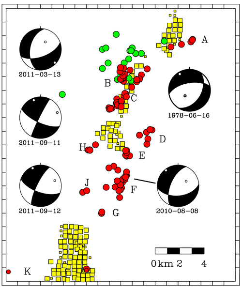
Map showing 2009–2011 earthquakes located in this study (red circles), gas injection wells active since 2004 (yellow squares), and focal mechanisms for regional events (beach balls). A series of small quakes occurred in the same region in 1979 and 1980 (green circles) and may have been related to injection of water for enhanced oil recovery. Sources: EarthScope, Texas Railroad Commission, S.T. Harding, and St. Louis University. Illustration by: Cliff Frohlich/University of Texas at Austin.
(Visited 23 times, 1 visits today)