
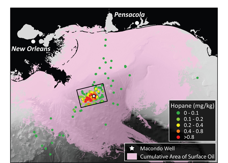
Map of the Northern Gulf of Mexico identifying the locations and extent of contamination for sampling sites used in this study. Sampling sites are identified as small circles with hotter colors indicating higher levels of contamination. For reference, the cumulative extent of oil at the sea surface is shown in pink, highlighting the differences in transport of surface slicks and oil suspended in the deep ocean waters. Figure by G. Burch Fisher, UCSB (Click image to enlarge)
(Visited 58 times, 1 visits today)