
Oncor Uses Breakthrough Technology from IBM Research and The Weather Company to Help Make Energy Grid More Reliable
NEW ORLEANS, Feb. 6, 2019 /PRNewswire/ — DISTRIBUTECH 2019 — IBM (NYSE: IBM) today unveiled new technology to reduce power outages by helping energy companies predict where trees and other vegetation may threaten power lines. IBM worked with Oncor, the largest utility company in Texas and the fifth largest in the U.S., to develop a solution tailored for the energy and utility industry, to help improve operations and provide reliable electric service for millions of customers across the state.
The Weather Company Vegetation Management – Predict is built on IBM PAIRS Geoscope, a groundbreaking technology developed by IBM Research. The system quickly processes massive, complex geospatial and time-based datasets collected by satellites, drones, aerial flights, millions of IoT sensors and weather models.
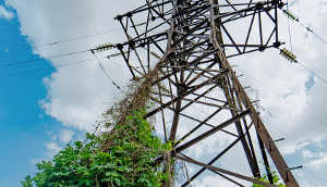
IBM PAIRS Geoscope technology from IBM Research make massive amounts of data manageable for any industry. This new solution focuses on the E&U industry to help reduce outages and maintain trimming costs. Image credit: IBM
The resulting insights can help companies like Oncor to monitor vegetation growth across their entire service territory, allowing them to better identify and predict potential infringement with power lines. Businesses can more proactively and accurately plan for preventive maintenance and rapid response, focusing crews in the highest-priority locations and validating that necessary trimming was completed as expected.
“Electricity is an essential part of our lives, and millions of Texans depend on Oncor every day. Vegetation poses a serious risk to power lines and the surrounding areas, but monitoring it is a challenging and time-consuming process,” said Peter Stoltman, vegetation management program manager, Oncor. “By working with IBM, we are able to use analytics and AI to prioritize high-risk areas. This helps us adapt maintenance operations to improve public safety and service reliability.”
Vegetation is a leading cause of service interruption for utility companies. With traditional approaches, the primary insight into potential risks involves expensive on-site inspections or knowing the last time an area was trimmed. With this new solution, hundreds of miles of transmission and distribution lines will be regularly monitored to provide continuous insight about the state of growth and maintenance. In addition to helping identify and predict outage threats, geospatial-temporal insights can help with overall grid reliability and compliance, wildfire prevention, storm management and assessment.
“Our utilities clients told us that getting detailed insight into the state of vegetation across their service territory was a key challenge,” said Mahesh Sudhakaran, chief digital officer of IBM Energy, Environment and Utilities. “By combining PAIRS with AI and industry expertise, we can give clients one integrated solution, delivered through IBM Hybrid Cloud, to help them predict and manage vegetation in a cost-effective and intelligent way.”
“Every business is affected by weather. But for energy companies and their customers, it can mean the difference between whether they can keep the lights on and heat their homes,” said Cameron Clayton, IBM’s general manager of Watson Media and Weather. “The ability to layer weather data with satellite and sensor data gives utility companies powerful new insights to help them improve operations and minimize impact on their customers.”
PAIRS Geoscope ingests more than 10 terabytes of new data per day and has already served more than 15 million requests from more than 4,000 researchers, data scientists and developers in 80 countries. It removes the labor-intensive process of generating insights from geospatial-temporal data, which is known for its sheer size and complexity. The inability to access, query and analyze this class of big data in a scalable way is the reason it was long considered unsearchable data. IBM scientists invented a new way to run and analyze complex queries within minutes instead of weeks or months, making previously impossible insights now a reality.
PAIRS Geoscope is generally available for different industries and use cases. In addition to Vegetation Management – Predict, PAIRS is also the underlying technology for Watson Decision Platform for Agriculture, a suite of agribusiness tools that uses the power of AI and geospatial data to help farmers make more informed decisions about their crops.
*Source: IBM