
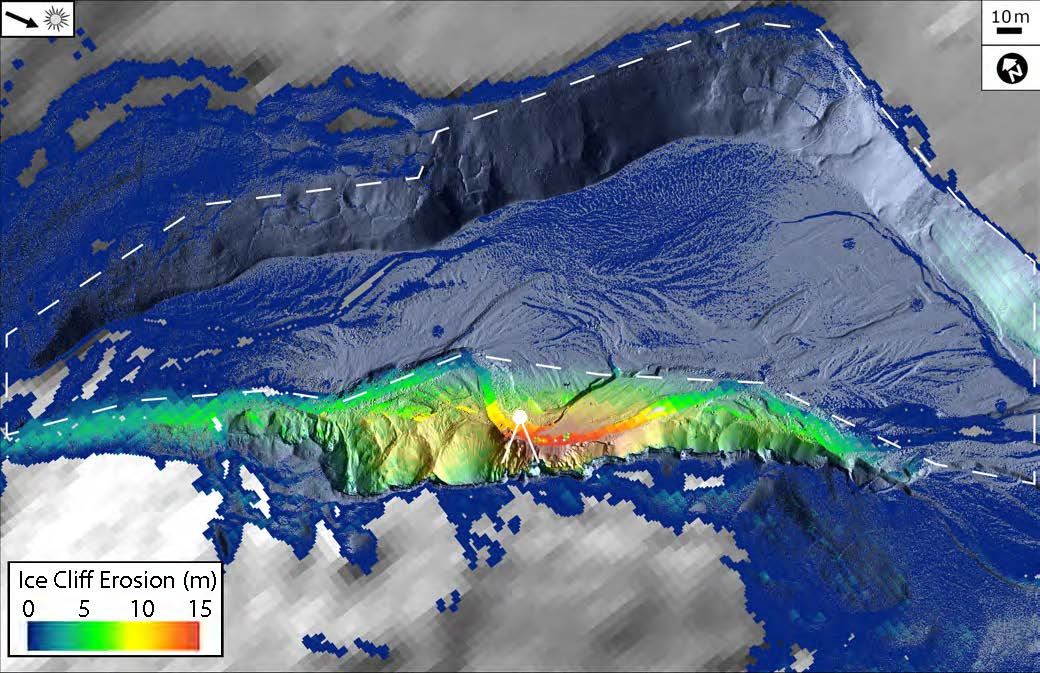
Ice cliff erosion since 2001. The solid white lines indicate infrared radiometer and sonic ranger field of view. Dashed line indicates area of erosion between initial ice/sediment deposition (Pleistocene/Holocene) and 2001. Image credit: Joseph Levy, University of Texas Institute for Geophysics. (Click image to enlage)
(Visited 9 times, 1 visits today)